3D Geodata Academy

Point Cloud

Tutorials that focus on 3D Point Cloud Processing.

This comprehensive collection of tutorials covers everything you need to know about processing 3D point clouds, including algorithms, tools, and best practices. Whether you’re a beginner or an expert, these open tutorials will help you master the art of 3D point cloud processing and take your skills to the next level. Check out our tutorials now and start exploring the world of 3D point cloud processing!

3D Euclidean Clustering Tutorial Cover

Python Guide for Euclidean Clustering of 3D Point Clouds

By Dr. Florent Poux, PhD in 3D geospatial sciences | Author, 3D Data Science with Python (O’Reilly) | Published 29 November 2024 Python Tutorial for Euclidean Clustering of 3D Point Clouds with Graph Theory. Fundamental concepts and sequential workflow for unsupervised segmentation. As you are developing the next generation of AI systems, you face a […]

Python Guide for Euclidean Clustering of 3D Point Clouds Read More »

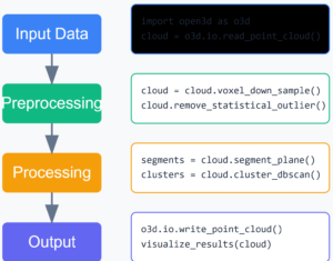
3D point cloud workflow

A Quick Dive into Modern Point Cloud Workflow

By Dr. Florent Poux, PhD in 3D geospatial sciences | Author, 3D Data Science with Python (O’Reilly) | Published 4 November 2024 Designing a point cloud workflow is a powerful first-hand approach in 3D data projects. This article explores how processing massive point clouds efficiently isn’t about having more computing power. It’s about being more […]

A Quick Dive into Modern Point Cloud Workflow Read More »

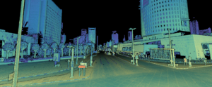
3D Point Cloud of a City

How to Quickly Visualize Massive Point Clouds with a No-Code Framework

By Dr. Florent Poux, PhD in 3D geospatial sciences | Author, 3D Data Science with Python (O’Reilly) | Published 21 October 2024 The average LiDAR scan contains 250+ million points. Visualizing and sharing this data efficiently is a significant challenge for many professionals. This tutorial provides a no-code solution to visualize and manage massive point […]

How to Quickly Visualize Massive Point Clouds with a No-Code Framework Read More »

3D Shape Detection with RANSAC and Python (Sphere and Plane)

By Dr. Florent Poux, PhD in 3D geospatial sciences | Author, 3D Data Science with Python (O’Reilly) | Published 19 July 2024 RANSAC detects spheres and planes in noisy 3D point clouds by repeatedly fitting a candidate model to a random sample of points and keeping the fit that explains the largest number of inliers. […]

3D Shape Detection with RANSAC and Python (Sphere and Plane) Read More »

Aerial LiDAR Point Cloud Feature Extraction Tutorial

Point Cloud Feature Extraction: Complete Guide

By Dr. Florent Poux, PhD in 3D geospatial sciences | Author, 3D Data Science with Python (O’Reilly) | Published 24 January 2024 This tutorial targets 3D Point Cloud Feature Extraction for developing an interactive Python Segmentation App. The goal is to develop an end-to-end system that can abstract complex point clouds with pertinent features. These […]

Point Cloud Feature Extraction: Complete Guide Read More »

3D Point Cloud Vectorization

Vectorization of 3D Point Cloud for LiDAR City Models

By Dr. Florent Poux, PhD in 3D geospatial sciences | Author, 3D Data Science with Python (O’Reilly) | Published 18 January 2024 3D Point Cloud Vectorization for LiDAR City Models This hands-on approach is standalone and covers the process of LiDAR Vectorization. We then focus on City Model Automatic Generation (LoD 0) in 5 main […]

Vectorization of 3D Point Cloud for LiDAR City Models Read More »

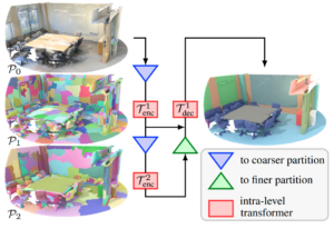
3D Shape Detection for Indoor Point Clouds

3D Shape Detection for Indoor Modelling

By Dr. Florent Poux, PhD in 3D geospatial sciences | Author, 3D Data Science with Python (O’Reilly) | Published 4 October 2023 A 10-step Python Guide to Automate 3D Shape Detection, Segmentation, Clustering, and Voxelization for Space Occupancy 3D Modeling of Indoor Point Cloud Datasets. If you have experience with point clouds or data analysis, […]

3D Shape Detection for Indoor Modelling Read More »

Scroll to Top