
3D Geodata Academy

Point Cloud

Tutorials that focus on 3D Point Cloud Processing.

This comprehensive collection of tutorials covers everything you need to know about processing 3D point clouds, including algorithms, tools, and best practices. Whether you’re a beginner or an expert, these open tutorials will help you master the art of 3D point cloud processing and take your skills to the next level. Check out our tutorials now and start exploring the world of 3D point cloud processing!

point cloud segmentation

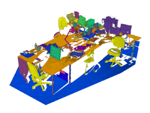
Learn 3D point cloud segmentation with Python

By Dr. Florent Poux, PhD in 3D geospatial sciences | Author, 3D Data Science with Python (O’Reilly) | Published 14 May 2021 Learn 3D point cloud segmentation with Python A complete python tutorial to automate point cloud segmentation and 3D shape detection using multi-order RANSAC and unsupervised clustering (DBSCAN). If you have worked with point […]

Learn 3D point cloud segmentation with Python Read More »
3D Point Cloud visualisation

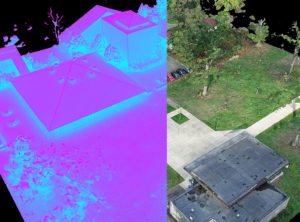
Visualise Massive point cloud in Python

By Dr. Florent Poux, PhD in 3D geospatial sciences | Author, 3D Data Science with Python (O’Reilly) | Published 16 February 2021 Visualise Massive point cloud in Python. Point clouds past the 10 million point mark are too dense for classical visualisation libraries such as Matplotlib, so this tutorial uses PPTK, which relies on an […]

Visualise Massive point cloud in Python Read More »

Data labelling

Free LiDAR point cloud for self-driving cars

By Dr. Florent Poux, PhD in 3D geospatial sciences | Author, 3D Data Science with Python (O’Reilly) | Published 9 December 2020 Scale AI released a new LiDAR point cloud dataset, and accelerate the growth of Autonomous Driving research. Point Cloud Data labelling Data labelling, also called data annotation/tagging/classification, is the process of tagging (i.e. […]

Free LiDAR point cloud for self-driving cars Read More »

Scroll to Top