
Master Point Cloud Processing with Python
From raw LiDAR data to automated classification and 3D modeling. 5 modules. Real datasets. Production Python code you can deploy today.
See the processing pipeline in action
From raw point cloud data to classified, modeled, and visualized 3D environments.
Points per pipeline. Built for production-scale LiDAR datasets.
Students trained, in 80 countries.
Production experience distilled into structured, repeatable workflows.
You can load a point cloud. Now what?
You have loaded LAS files in Python. You have visualized them in Open3D or CloudCompare. Maybe you ran a downsampling function from a tutorial. But when your boss asks you to automate classification of a 100-million-point airborne scan, extract building footprints, and generate a 3D mesh, you have no idea where to start.
The gap is not loading data. It is understanding the complete processing chain: which algorithms to use in which order, how to handle scale, and how to go from raw points to actionable intelligence.
Every 3D pipeline starts with point clouds. LiDAR, photogrammetry, depth cameras, Gaussian Splatting: they all produce or consume point cloud data. Master point cloud processing, and you unlock every downstream application: digital twins, autonomous driving, BIM, forestry, mining, urban planning. This is the base layer.
What you’ll build
Real processing pipelines on real datasets. Not toy examples.

Data processing engine
Parse, filter, downsample, and structure massive point clouds. Handle E57, LAS, PLY with proper memory management at scale.

Automated segmentation
RANSAC plane extraction, DBSCAN clustering, and region growing. Separate ground, buildings, vegetation, and objects automatically.

Feature extraction
Compute geometric features, normal vectors, curvatures, and eigenvalue-based descriptors. The input layer for any ML pipeline on 3D data.

3D modeling
From classified points to meshes, voxels, and parametric models. Build the output formats your clients and downstream pipelines need.

Analytics and visualization
Volume computation, change detection, cross-section analysis. Extract quantitative intelligence from 3D data with publication-quality visualizations.

Production workflows
End-to-end automated pipelines. From raw file ingestion to classified output with proper error handling, logging, and batch processing.
I designed this course as the foundation I wish I had when I started working with LiDAR data 12 years ago. Every algorithm choice, every memory optimization, every processing trick comes from real projects where getting it wrong cost time and money.
How this course works
Hands-on, production-focused, and built for working professionals.
100% asynchronous
Access everything 24/7 on the LMS. Self-paced. No live sessions required.
Code-along projects
Every module ships with complete Python source code and real LiDAR datasets. Run it, modify it, ship it.
Real datasets
Airborne LiDAR, terrestrial scans, indoor environments. Millions of real points, not synthetic data.
Production patterns
Memory-efficient processing, batch workflows, error handling. Code that works on 100M points, not just 10K.
Lifetime access
One payment, permanent access. Every future update included.
Upgrade path
This course is the foundation for the Spatial OS and Segmentor OS. Build your base here.
Point cloud processing is the entry point for every 3D career path: digital twins, autonomous driving, BIM, forestry, mining, urban planning. Master this, and you have the foundation for anything you want to build in 3D. This course gives you that foundation directly and practically.
The Curriculum
5 modules. From raw data to production intelligence.
Prerequisites
This course is designed for Python developers who want to work with 3D data.
- Python (beginner+): comfortable with loops, functions, file I/O, and basic NumPy operations
- Hardware: 16 GB RAM recommended for large dataset modules. No GPU required
- Software: Windows, Linux, or Mac. All tools are free and open-source
No prior 3D or point cloud experience required. This is the starting point.
Load, visualize, and understand LAS, E57, PLY files. Build data structures, compute statistics, and set up your processing environment.
Filter, downsample, compute normals, and structure point clouds for downstream processing. Handle 100M+ points without running out of memory.
Automatically classify point clouds into ground, buildings, vegetation, and objects. RANSAC, DBSCAN, and region growing for production segmentation.
Extract quantitative intelligence from 3D data. Geometric features, volume computation, change detection, and cross-section analysis.
From classified points to usable 3D models. Mesh generation, voxelization, parametric fitting, and export to standard formats.
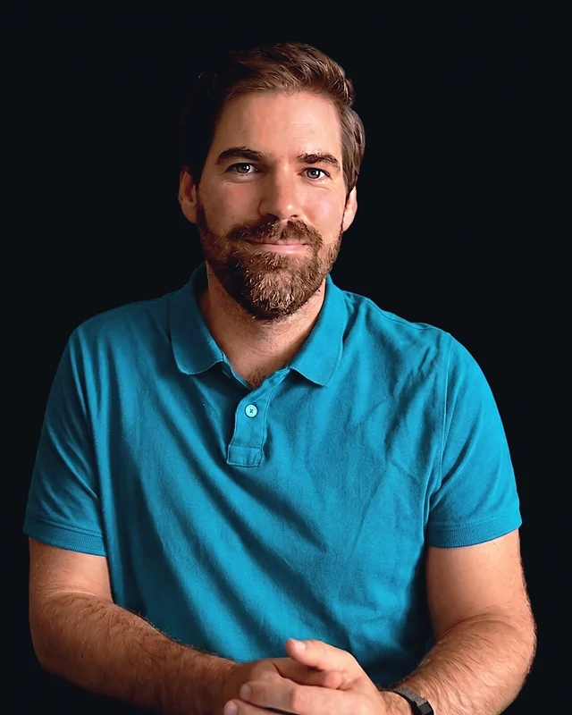
Your instructor
Dr. Florent Poux
I’ve spent 15+ years in 3D geospatial: from field surveys with total stations to building AI systems for Fortune 500 companies. I published the O’Reilly book on 3D Data Science with Python. I’ve advised startups valued at over 15M EUR. I’ve held a professorship, taught at university, and led R&D for some of the largest organizations in the space.
I don’t teach syntax. I teach judgment. Every module is built around real decisions I’ve faced in production. Which neural renderer fits an industrial inspection job. How to architect a semantic pipeline that doesn’t choke on 500M points. When to use algorithmic methods and when to switch to deep learning.
What students say
Engineers, GIS professionals, and researchers from 80 countries.
“Our team processed 200M points for a highway survey. Before this course, we were stuck at 10M with crashes. The memory management module saved us weeks of work.”

“I’m a surveyor with 20 years of field experience. This gave me the Python and AI skills to modernize our entire workflow. Best investment I’ve made in my career.”
“RANSAC plus DBSCAN on a 120M-point mining dataset, segmented, volumetric change detected, and report ready in one afternoon. That used to take a week.”
“This course is the foundation I wish I had when I started with LiDAR. The feature extraction module alone reshaped how I approach every project.”
Get lifetime access
One payment. Every module, every update, every processing pipeline.
Point Cloud Intelligence
Complete processing curriculum + source code + real LiDAR datasets + lifetime updates
- 5 modules (25+ hours)i
- Complete Python source code + datasets
- Production segmentation pipelines
- Feature extraction and analytics
- Lifetime access + all future updatesi
- 90-day results guaranteei
Zero-risk guarantee: If you don’t see real results within 90 days, I’ll refund you in full. No questions.
The complete ecosystem
3D AI Architect Program
The complete spatial AI curriculum, delivered in 3 tiers. Pick the depth that matches where you are: Foundation to get moving, Professional for the full OS stack, Architect for the co-built, one to one route.
- 3D AI Acceleratori: 17 episodes in 6 acts
- 3D Course Libraryi: every standalone course I publish
- All 4 OS courses (Professional and Architect tiers)
- Neurones 3D software access
- Monthly drop-in sessions with Dr. Poux (Architect)
- Spatial AI job and market intel
- Priority support + services access (Architect)
- 300+ hours of content
What you’re getting access to
Everything I’ve built over 15+ years, from land surveying in the field to advising 15M EUR startups, compressed into one curriculum you can start today. Delivered by the first QUALIOPI-certified 3D geospatial academy.
Every pipeline was battle-tested on Fortune 500 projects processing billions of points. You’re getting the real playbook, not theory.
Methods validated by peer-reviewed publications, the ISPRS scientific community, and 1,700+ Google Scholar citations. Not guesswork.
Built by someone who surveyed in the field, defended a PhD, advised funded startups, and shipped products to Fortune 500 clients.
I share more free content than most people put behind a paywall. That’s intentional. I want you to know exactly what you’re getting before you invest. This course is the concentrated, structured version of everything I know. No fluff. No filler. Just the production path.
Find the right path for you
From single courses to the complete ecosystem.
| Feature | Standalone Course | Point Cloud Intelligence | Course Library | 3D AI Architecti | Enterprise |
|---|---|---|---|---|---|
| Courses included | 1 topic | 5 modules | Full catalogi | 3 OS courses + Library (tiered) | Custom |
| Hours of content | 2-8h | 25+ hours | 150+ hours | 300+ hours (tiered) | Custom |
| Production source code | ✓ | ✓ | ✓ | ✓ | ✓ |
| Lifetime access | ✓ | ✓ | – | ✓ | ✓ |
| 3D AI Accelerator Tracki | – | – | – | ✓ | ✓ |
| Neurones 3D softwarei | – | – | – | ✓ | ✓ |
| Spatial AI job & market inteli | – | – | – | ✓ | ✓ |
| Monthly drop-in sessionsi | – | – | – | ✓ | ✓ |
| Priority support + services accessi | – | – | – | ✓ tiered | ✓ |
| Custom onboardingi | – | – | – | – | ✓ |
| Team licensing | – | – | – | – | ✓ |
| Price | €97 – €1,497 | €597 | €297 / 3 months | Starts at €1,997 | On request |
Straight answers
Do I need prior 3D or point cloud experience?
No. This is the starting point. You need basic Python skills. I build the 3D intuition from the ground up.
What software do I need?
Python, Open3D, NumPy, and a few open-source libraries. All free. No paid software required.
What hardware do I need?
Minimum 8 GB RAM for basic modules, 16 GB+ recommended for large dataset processing. No GPU required.
How long do I have access?
Lifetime. One payment, permanent access. Every future update included.
What’s the refund policy?
90 days. Process some data, build a pipeline. If you are not satisfied, email me for a full refund.
Is this enough to get a 3D data job?
This course gives you the technical foundation that employers need. Combined with a portfolio project (which you will build in the course), it makes you hirable for point cloud processing and 3D data engineering roles.
How is this different from free Open3D tutorials?
Tutorials teach individual functions. This course teaches the complete processing chain: which algorithms to use, in which order, at what scale. Free content gives you pieces. This gives you the system.
Can I upgrade to the Spatial OS later?
Yes. This course builds the foundation. When you are ready for graph intelligence, AI agents, and production deployment, you can upgrade. Contact me for credit toward the OS.
Not sure if this course fits?
If you have specific questions about how the curriculum applies to your role, your team’s needs, or your technical background, I’m happy to help you figure it out before you commit.
Book a 15-min call